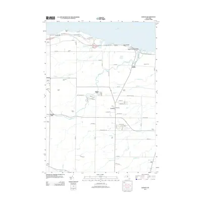
2013 Map of Hamlin
USGS Topo · Published 2013About this map
Lake Ontario defines the northern reaches of this coastal landscape, where the distinct landform of Devils Nose and Bluff Beach meet the water. The 2013 topography reveals a region deeply tied to its agricultural heritage, with numerous family-run operations like Hurd Orchards, Heberle Farms, and Partyka Farms scattered across the drainage basins of Yanty Cr and Sandy Cr. The central settlement of Hamlin serves as a local hub, connected by the Lake Ontario State Parkway to lakeside communities such as Sandy Harbour Beach and Troutburg. Smaller inland hamlets like North Hamlin and Kendall Mills preserve the historical footprint of Monroe County, while sites like Morton Union Cem and Blossom Cem provide essential reference points for genealogists. The map also highlights local infrastructure, including the Brockport Waterworks and the recreational space at Harper Park, illustrating the balance between utility and preservation along the lake's southern shore.
Find a feature on this map
81 named features on this map. Tap any name to fly to it.
Don’t see what you’re looking for? This feature index may not catch every label — zoom into the map to look around manually.
Map Details
Editions of this 2013 Hamlin Map
This is the sole edition of this map. No revisions or reprints were ever made.
Other maps of this area

1897 · Albion
USGS Topo · 1:62,500

1897 · Oak Orchard
USGS Topo · 1:62,500

1899 · Hamlin
USGS Topo · 1:62,500

1899 · Brockport
USGS Topo · 1:62,500

1932 · Hamlin
USGS Topo · 1:24,000

1932 · Spencerport
USGS Topo · 1:24,000

1934 · Spencerport
USGS Topo · 1:24,000

1934 · Brockport
USGS Topo · 1:24,000
1934 · Hilton
USGS Topo · 1:24,000

1935 · Hamlin
USGS Topo · 1:24,000