
1934 Map of Spencerport
USGS Topo · Published 1934About this map
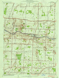
The New York State Barge Canal bisects the landscape of Monroe County, defining the growth and layout of settlements like Spencerport and Adams Basin in the early 1930s. This survey reveals a transition from the canal-side industrial infrastructure, such as the Spencerport Waterworks and a nearby Sewage Disposal Plant, to a predominantly rural school district system. The map documents a dense network of local education, with thirteen numbered schoolhouses including School No. 11 and School No. 5 serving the surrounding agricultural townships.
Find a feature on this map
75 named features on this map. Tap any name to fly to it.
Don’t see what you’re looking for? This feature index may not catch every label — zoom into the map to look around manually.
Map Details
Editions of this 1934 Spencerport Map
2 editions found
Other maps of this area

1895 · Rochester
USGS Topo · 1:62,500

1895 · Ontario Beach
USGS Topo · 1:62,500

1898 · Rochester
USGS Topo · 1:62,500

1899 · Hamlin
USGS Topo · 1:62,500

1899 · Ontario Beach
USGS Topo · 1:62,500

1899 · Brockport
USGS Topo · 1:62,500

1912 · Rochester
USGS Topo · 1:62,500

1912 · Ontario Beach
USGS Topo · 1:62,500

1920 · Rochester
USGS Topo · 1:62,500

1931 · Rochester West
USGS Topo · 1:24,000