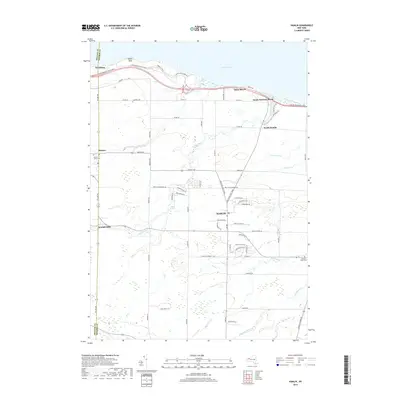
2019 Map of Hamlin
USGS Topo · Published 2019About this map
Lake Ontario defines the northern reaches of this coastal landscape, where the prominent shoreline feature of Devils Nose sits just west of Hamlin Beach State Park. The region's agricultural and maritime character is reflected in the network of creeks including Sandy Creek, Brush Cr, and Cowsucker Cr that drain toward the lake. Small communities such as Troutburg, Morton, and North Hamlin serve as local hubs, while the larger center of Hamlin anchors the southern half of the sheet. The map documents significant local history sites for genealogists, featuring Lakeside Cem, Morton Union Cem, and Clarkson Union Cem. Transportation corridors like the Lake Ontario State Pkwy parallel the coast, connecting the seasonal beach settlements of Onteo Beach and Sandy Harbour Beach with the interior farm lands.
Find a feature on this map
70 named features on this map. Tap any name to fly to it.
Don’t see what you’re looking for? This feature index may not catch every label — zoom into the map to look around manually.
Map Details
Editions of this 2019 Hamlin Map
This is the sole edition of this map. No revisions or reprints were ever made.
Other maps of this area

1897 · Albion
USGS Topo · 1:62,500

1897 · Oak Orchard
USGS Topo · 1:62,500

1899 · Hamlin
USGS Topo · 1:62,500

1899 · Brockport
USGS Topo · 1:62,500

1932 · Hamlin
USGS Topo · 1:24,000

1932 · Spencerport
USGS Topo · 1:24,000

1934 · Spencerport
USGS Topo · 1:24,000

1934 · Brockport
USGS Topo · 1:24,000
1934 · Hilton
USGS Topo · 1:24,000

1935 · Hamlin
USGS Topo · 1:24,000