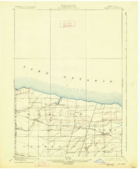
1899 Map of Hamlin
USGS Topo · Published 1926About this map
Lake Ontario defines the northern reaches of this late 19th-century landscape, where the fertile plains of western Monroe County meet the shoreline. The regional economy is anchored by the Rome Watertown and Ogdensburg R. R. (Niagara Falls Line), which cuts a diagonal path through the township, connecting agricultural hubs like Hamlin and Hilton. Further south, the historic Ridge Road runs parallel to the lake, following a prehistoric shoreline that served as a vital early transportation corridor for the region.
Find a feature on this map
25 named features on this map. Tap any name to fly to it.
Don’t see what you’re looking for? This feature index may not catch every label — zoom into the map to look around manually.
Map Details
Editions of this 1899 Hamlin Map
4 editions found
Other maps of this area

1895 · Rochester
USGS Topo · 1:62,500

1895 · Ontario Beach
USGS Topo · 1:62,500

1897 · Albion
USGS Topo · 1:62,500

1897 · Oak Orchard
USGS Topo · 1:62,500

1898 · Rochester
USGS Topo · 1:62,500

1899 · Hamlin
USGS Topo · 1:62,500

1899 · Ontario Beach
USGS Topo · 1:62,500

1899 · Brockport
USGS Topo · 1:62,500

1912 · Rochester
USGS Topo · 1:62,500

1912 · Ontario Beach
USGS Topo · 1:62,500