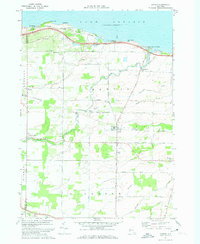
1971 Map of Hamlin
USGS Topo · Published 1973About this map
Lake Ontario defines the northern edge of this landscape, where the Hamlin Beach State Park and Yanty Marsh sit alongside the winding Lake Ontario State Parkway. Moving inland, the map shows a fertile agricultural region in the early 1970s, characterized by a grid of rural roads like Moscow Road and Redman Road that link small settlements. The area is intersected by several waterways, including Sandy Creek and Cowsucker Creek, which drain toward the lake.
Find a feature on this map
46 named features on this map. Tap any name to fly to it.
Don’t see what you’re looking for? This feature index may not catch every label — zoom into the map to look around manually.
Map Details
Editions of this 1971 Hamlin Map
This is the sole edition of this map. No revisions or reprints were ever made.
Other maps of this area

1897 · Albion
USGS Topo · 1:62,500

1897 · Oak Orchard
USGS Topo · 1:62,500

1899 · Hamlin
USGS Topo · 1:62,500

1899 · Brockport
USGS Topo · 1:62,500

1932 · Hamlin
USGS Topo · 1:24,000

1932 · Spencerport
USGS Topo · 1:24,000

1934 · Spencerport
USGS Topo · 1:24,000

1934 · Brockport
USGS Topo · 1:24,000
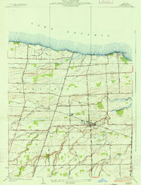
1934 · Hilton
USGS Topo · 1:24,000

1935 · Hamlin
USGS Topo · 1:24,000