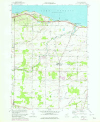
1978 Map of Hamlin
USGS Topo · Published 1978About this map
Lake Ontario shorelines and the fertile agricultural plains of Monroe and Orleans Counties define this 1970s landscape. Much of the northern waterfront is dedicated to recreation, specifically at Hamlin Beach State Park, where landmarks like Devils Nose and Yanty Marsh mark the transition from water to land. The inland area reflects a deeply rooted rural infrastructure, with small settlements like Kendall Mills and North Hamlin serving as hubs for the surrounding farmsteads.
Find a feature on this map
45 named features on this map. Tap any name to fly to it.
Don’t see what you’re looking for? This feature index may not catch every label — zoom into the map to look around manually.
Map Details
Editions of this 1978 Hamlin Map
This is the sole edition of this map. No revisions or reprints were ever made.
Other maps of this area

1897 · Albion
USGS Topo · 1:62,500

1897 · Oak Orchard
USGS Topo · 1:62,500

1899 · Hamlin
USGS Topo · 1:62,500

1899 · Brockport
USGS Topo · 1:62,500

1932 · Hamlin
USGS Topo · 1:24,000

1932 · Spencerport
USGS Topo · 1:24,000

1934 · Spencerport
USGS Topo · 1:24,000

1934 · Brockport
USGS Topo · 1:24,000
1934 · Hilton
USGS Topo · 1:24,000

1935 · Hamlin
USGS Topo · 1:24,000