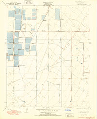
1950 Map of Hamlin School
USGS Topo · Published 1950About this map
Dozens of private sporting clubs dominate this portion of Kern County, where the landscape is etched with the geometric patterns of irrigation canals and managed water. The 1950 landscape is characterized by a high concentration of gun clubs, including the Hollywood Gun Club, Savoy Gun Club, and the Pajaro Land and Water Co Gun Club. These numerous recreational enclaves, alongside the Lurline Gun Club and Glendale Gun Club, suggest a mid-century period when waterfowl hunting and water management were central to the area's land use.
Find a feature on this map
17 named features on this map. Tap any name to fly to it.
Don’t see what you’re looking for? This feature index may not catch every label — zoom into the map to look around manually.
Map Details
Editions of this 1950 Hamlin School Map
This is the sole edition of this map. No revisions or reprints were ever made.
Other maps of this area

1914 · Lost Hills
USGS Topo · 1:125,000

1927 · Semitropic
USGS Topo · 1:31,680

1929 · Hacienda Ranch
USGS Topo · 1:31,680

1929 · Stone
USGS Topo · 1:31,680

1929 · Allensworth
USGS Topo · 1:31,680

1930 · Leonards
USGS Topo · 1:31,680

1930 · Hamlin School
USGS Topo · 1:31,680

1930 · Wasco
USGS Topo · 1:31,680

1930 · Pond
USGS Topo · 1:31,680

1930 · Miramonte Ranch
USGS Topo · 1:31,680