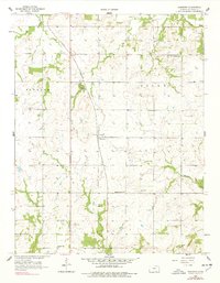
1958 Map of Hammond
USGS Topo · Published 1978About this map
Hammond serves as the central hub for this portion of Bourbon County, situated along the tracks of the St Louis San Francisco railroad. The surrounding landscape is defined by the rural development patterns of the mid-20th century, where small community schools and cemeteries mark the intersections of section lines. Family history is anchored in sites like West Liberty Sch and Maple Grove Sch, alongside several burial grounds including Glendale Cem.
Find a feature on this map
19 named features on this map. Tap any name to fly to it.
Don’t see what you’re looking for? This feature index may not catch every label — zoom into the map to look around manually.
Map Details
Editions of this 1958 Hammond Map
2 editions found
Other maps of this area

1884 · Fort Scott
USGS Topo · 1:125,000

1886 · Fort Scott
USGS Topo · 1:125,000

1887 · Mound City
USGS Topo · 1:125,000

1893 · Fort Scott
USGS Topo · 1:125,000

1893 · Mound City
USGS Topo · 1:125,000

1939 · Deerfield
USGS Topo · 1:24,000

1940 · Hume
USGS Topo · 1:24,000

1942 · Hume
USGS Topo · 1:24,000

1942 · Richards
USGS Topo · 1:24,000

1942 · Deerfield
USGS Topo · 1:24,000