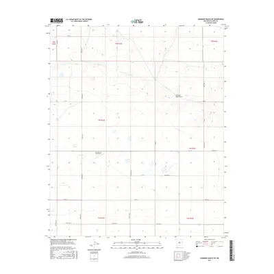
2017 Map of Hammond Ranch SW
USGS Topo · Published 2017About this map
Running Water Draw winds through this section of the High Plains, carving a distinct drainage pattern across the landscape of Curry County. The agricultural and aviation character of the region is anchored by the Lockmiller & Sons Airport, which sits at a central intersection within the Public Land Survey System grid. This 2017 survey by the U.S. Geological Survey documents a highly organized network of section-line roads, including Curry Road 17 and Curry Road Z, which define the ranching and farming parcels of the Llano Estacado. The map details the transition between township boundaries such as t4n r33e and t5n r33e, showing how modern infrastructure and legacy land divisions remain tightly integrated in this rural corner of eastern New Mexico.
Find a feature on this map
27 named features on this map. Tap any name to fly to it.
Don’t see what you’re looking for? This feature index may not catch every label — zoom into the map to look around manually.
Map Details
Editions of this 2017 Hammond Ranch SW Map
This is the sole edition of this map. No revisions or reprints were ever made.
Other maps of this area

1954 · Clovis
USGS Topo · 1:250,000

1957 · Portair
USGS Topo · 1:62,500

1957 · Melrose
USGS Topo · 1:62,500

1957 · Hammond Ranch
USGS Topo · 1:62,500

1958 · Clovis
USGS Topo · 1:250,000

1972 · Melrose East
USGS Topo · 1:24,000

1973 · Field SE
USGS Topo · 1:24,000
1973 · Field
USGS Topo · 1:24,000

1985 · Portair
USGS Topo · 1:24,000

1985 · Smith Ranch
USGS Topo · 1:24,000