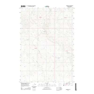
2014 Map of Hammond SE
USGS Topo · Published 2014About this map
Lanning Ranch Airport serves as a key landmark in this corner of Carter County, where the high plains transition into a series of ridges and drainages. The landscape is defined by the three branches of the Willow Creek system, including N Fork Willow Cr, Middle Fork Willow Cr, and S Fork Willow Cr, which carve through the terrain alongside Deadman Cr. Ranching history is etched into the map through a network of family-named routes and trails such as Lannings Rd, Larsons Rd, and Kaufman Trl. The prominence of Alzada Ridge and the accompanying Alzada Ridge Rd provides a natural corridor through this sparsely populated territory. This 2014 data captures the intersection of traditional land use and modern topographical documentation in the southeastern Montana ranchlands.
Find a feature on this map
18 named features on this map. Tap any name to fly to it.
Don’t see what you’re looking for? This feature index may not catch every label — zoom into the map to look around manually.
Map Details
Editions of this 2014 Hammond SE Map
This is the sole edition of this map. No revisions or reprints were ever made.
Other maps of this area

1905 · Devils Tower
USGS Topo · 1:125,000

1954 · Ekalaka
USGS Topo · 1:250,000

1954 · Gillette
USGS Topo · 1:250,000

1955 · Gillette
USGS Topo · 1:250,000

1956 · Ekalaka
USGS Topo · 1:250,000

1957 · Seely
USGS Topo · 1:62,500

1957 · Cedar Ridge
USGS Topo · 1:62,500

1958 · Gillette
USGS Topo · 1:250,000

1958 · Ekalaka
USGS Topo · 1:250,000

1962 · Gillette
USGS Topo · 1:250,000