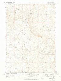
1970 Map of Hammond SE
USGS Topo · Published 1973About this map
Deadman Creek and its many seasonal tributaries define this high plains landscape at the border of Montana and Wyoming. The 1970 survey captures a region primarily utilized for ranching and resource exploration, as indicated by the presence of numerous Drill Holes and a Well scattered across the upland divides. The terrain is deeply incised by the drainage systems of the North Fork, Middle Fork, and South Fork Willow Creek, which flow through the northern half of the quadrangle. At the southern edge, the Carter County and Crook County line marks the administrative transition across this open range. This map records the exact positioning of fine-line ranch fencing and pipeline corridors that were essential to the local livestock and energy economy during the early 1970s.
Find a feature on this map
11 named features on this map. Tap any name to fly to it.
Don’t see what you’re looking for? This feature index may not catch every label — zoom into the map to look around manually.
Map Details
Editions of this 1970 Hammond SE Map
This is the sole edition of this map. No revisions or reprints were ever made.
Other maps of this area

1905 · Devils Tower
USGS Topo · 1:125,000

1954 · Ekalaka
USGS Topo · 1:250,000

1954 · Gillette
USGS Topo · 1:250,000

1955 · Gillette
USGS Topo · 1:250,000

1956 · Ekalaka
USGS Topo · 1:250,000

1957 · Seely
USGS Topo · 1:62,500

1957 · Cedar Ridge
USGS Topo · 1:62,500

1958 · Gillette
USGS Topo · 1:250,000

1958 · Ekalaka
USGS Topo · 1:250,000

1962 · Gillette
USGS Topo · 1:250,000