
1949 Map of Hammond
USGS Topo · Published 1953About this map
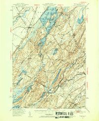
Black Lake dominates this northern landscape, its irregular shoreline defined by points like McNeil Pt and numerous islands including Conger Island and Big Island. This 1949 survey illustrates a rural economy centered on the river systems and the New York Central railroad, which served settlements from North Hammond through Oakvale Station. In the village of Hammond, the presence of the Hammond Airport and Hammond Cem marks a local hub of activity near the St. Lawrence and Jefferson County line.
Find a feature on this map
84 named features on this map. Tap any name to fly to it.
Don’t see what you’re looking for? This feature index may not catch every label — zoom into the map to look around manually.
Map Details
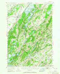
Editions of this 1949 Hammond Map
3 editions found
Other maps of this area

1903 · Alexandria Bay
USGS Topo · 1:62,500

1903 · Theresa
USGS Topo · 1:62,500

1904 · Ogdensburg
USGS Topo · 1:62,500

1905 · Ogdensburg
USGS Topo · 1:62,500

1906 · Brier Hill
USGS Topo · 1:62,500

1911 · Antwerp
USGS Topo · 1:62,500

1912 · Hammond
USGS Topo · 1:62,500

1913 · Lake Bonaparte
USGS Topo · 1:62,500

1915 · Gouverneur
USGS Topo · 1:62,500

1916 · Lake Bonaparte
USGS Topo · 1:62,500