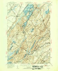
1949 Map of Hammond
USGS Topo · Published 1953About this map
Black Lake and its many islands, including Big Island and Tin Island, dominate this post-war landscape across the St Lawrence and Jefferson county line. The region is defined by a heavy concentration of rural one-room schoolhouses, such as Stark Sch and South Woods Sch, alongside the agricultural and transport hubs of Hammond and Rossie. The New York Central line runs through the western corridor, serving communities like South Hammond and Oakvale Station. To the east, the Oswegatchie River winds through Natural Dam and Wegatchie, supporting local industry and the community at Somerville. Genealogists will find a wealth of burial grounds including Riverside Cem and St Patricks Cem, while landmarks like Pulpit Rock and the Hammond Airport mark the era's physical geography.
Find a feature on this map
87 named features on this map. Tap any name to fly to it.
Don’t see what you’re looking for? This feature index may not catch every label — zoom into the map to look around manually.
Map Details
Editions of this 1949 Hammond Map
3 editions found

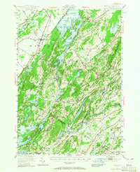
Other maps of this area

1903 · Alexandria Bay
USGS Topo · 1:62,500

1903 · Theresa
USGS Topo · 1:62,500

1904 · Ogdensburg
USGS Topo · 1:62,500

1905 · Ogdensburg
USGS Topo · 1:62,500

1906 · Brier Hill
USGS Topo · 1:62,500

1911 · Antwerp
USGS Topo · 1:62,500

1912 · Hammond
USGS Topo · 1:62,500

1913 · Lake Bonaparte
USGS Topo · 1:62,500

1915 · Gouverneur
USGS Topo · 1:62,500

1916 · Lake Bonaparte
USGS Topo · 1:62,500