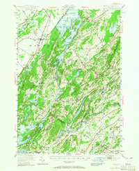
1949 Map of Hammond
USGS Topo · Published 1965About this map
The Oswegatchie River and Black Lake define the complex geography of this Northern New York landscape at the close of the 1940s. The region is marked by a dense network of local schools and churches that speak to a well-established rural social structure, including the Scotch Settlement Sch, St Patricks Ch, and California Sch. Settlement clusters at Rossie, Hammond, and Oxbow are linked by the New York Central railroad, which provided vital transit through Oakvale Station.
Find a feature on this map
93 named features on this map. Tap any name to fly to it.
Don’t see what you’re looking for? This feature index may not catch every label — zoom into the map to look around manually.
Map Details
Editions of this 1949 Hammond Map
3 editions found

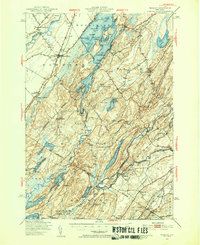
Other maps of this area

1903 · Alexandria Bay
USGS Topo · 1:62,500

1903 · Theresa
USGS Topo · 1:62,500

1904 · Ogdensburg
USGS Topo · 1:62,500

1905 · Ogdensburg
USGS Topo · 1:62,500

1906 · Brier Hill
USGS Topo · 1:62,500

1911 · Antwerp
USGS Topo · 1:62,500

1912 · Hammond
USGS Topo · 1:62,500

1913 · Lake Bonaparte
USGS Topo · 1:62,500

1915 · Gouverneur
USGS Topo · 1:62,500

1916 · Lake Bonaparte
USGS Topo · 1:62,500