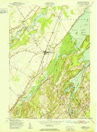
1951 Map of Hammond
USGS Topo · Published 1951About this map
Hammond serves as the central hub of this northern St. Lawrence County landscape, situated where the New York Central railroad corridor intersects several local roads near the mid-century. The settlement pattern is defined by several distinct community clusters, including North Hammond, South Hammond, and the village of Rossie along the Indian River. These hamlets are linked by historical thoroughfares such as Sand Street and Oak Point Road.
Find a feature on this map
33 named features on this map. Tap any name to fly to it.
Don’t see what you’re looking for? This feature index may not catch every label — zoom into the map to look around manually.
Map Details
Editions of this 1951 Hammond Map
2 editions found
Other maps of this area

1903 · Alexandria Bay
USGS Topo · 1:62,500

1906 · Brier Hill
USGS Topo · 1:62,500

1912 · Hammond
USGS Topo · 1:62,500

1942 · Morristown
USGS Topo · 1:24,000

1943 · Morristown
USGS Topo · 1:31,680

1943 · Redwood
USGS Topo · 1:31,680

1943 · Edwardsville
USGS Topo · 1:31,680

1944 · Hammond
USGS Topo · 1:62,500

1948 · Chippewa Bay
USGS Topo · 1:24,000

1948 · Alexandria Bay
USGS Topo · 1:62,500