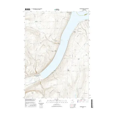
2016 Map of Hammondsport
USGS Topo · Published 2016About this map
Hammondsport sits at the southern fork of Keuka Lake, where the shoreline topography creates a distinct pattern of lakeside settlements and upland farming. The village is anchored by the Keuka Inlet and historic burial grounds like Elmwood Cem, while the surrounding slopes of Mt Washington and Urbana Gulch reveal the steep terrain that defines the Finger Lakes region. Small hamlets such as Urbana and Glen Grove are connected by a network of winding roads including Winding Stairs Rd and S Pulteney Rd. This map captures the modern layout of these lakeside communities, showing the relationship between protected valleys like Birdseye Hollow and the numerous springs and brooks, such as Cedar Springs and Glen Brook, that feed into the deep glacial lake.
Find a feature on this map
82 named features on this map. Tap any name to fly to it.
Don’t see what you’re looking for? This feature index may not catch every label — zoom into the map to look around manually.
Map Details
Editions of this 2016 Hammondsport Map
This is the sole edition of this map. No revisions or reprints were ever made.
Other maps of this area

1900 · Naples
USGS Topo · 1:62,500

1903 · Naples
USGS Topo · 1:62,500

1903 · Penn Yan
USGS Topo · 1:62,500

1903 · Hammondsport
USGS Topo · 1:62,500

1910 · Bath
USGS Topo · 1:62,500

1913 · Naples
USGS Topo · 1:62,500

1942 · Prattsburg
USGS Topo · 1:31,680

1942 · Pulteney
USGS Topo · 1:31,680

1942 · Keuka Park
USGS Topo · 1:24,000

1943 · Keuka Lake
USGS Topo · 1:31,680