1966 Map of Hammonton
USGS Topo · Published 1974About this map
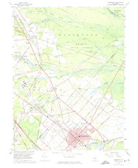
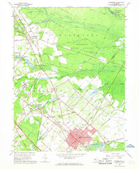
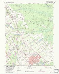
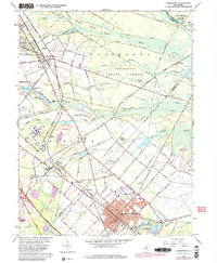
The town of Hammonton stands as a significant hub in the Pine Barrens landscape of the mid-1960s, surrounded by a dense network of fruit farms and Atlantic County forest. This area is defined by its complex transportation history, most notably at Winslow Junction, where the Central Railroad of New Jersey and the Pennsylvania-Reading Seashore Lines intersect. These rail corridors, alongside the White Horse Pike, once fueled the regional economy by connecting the agricultural interior with coastal resorts and Philadelphia markets.
Find a feature on this map
99 named features on this map. Tap any name to fly to it.
Don’t see what you’re looking for? This feature index may not catch every label — zoom into the map to look around manually.
Map Details
Editions of this 1966 Hammonton Map
4 editions found
Other maps of this area

1888 · Pemberton
USGS Topo · 1:62,500

1888 · Mount Holly
USGS Topo · 1:62,500

1890 · Hammonton
USGS Topo · 1:62,500

1890 · Mullica
USGS Topo · 1:62,500

1894 · Hammonton
USGS Topo · 1:62,500

1894 · Pemberton
USGS Topo · 1:62,500

1894 · Mount Holly
USGS Topo · 1:62,500

1894 · Mullica
USGS Topo · 1:62,500

1898 · Pemberton
USGS Topo · 1:62,500

1898 · Mount Holly
USGS Topo · 1:62,500