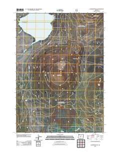
2011 Map of Hamner Butte
USGS Topo · Published 2011About this map
Hamner Butte and its surrounding peaks dominate this landscape in Deschutes County, revealing a volcanic topography defined by cinder cones and basalt flows. To the north, the waters of Davis Lake are fed by Ranger Creek and Odell Creek, the latter of which marks a significant riparian corridor through the high-elevation terrain. This 2011 survey documents the remote character of the area, where human presence is limited to sparse infrastructure like Co HWY 1352 and the isolated Black Rock Ranch near the southern boundary. The map illustrates a complex network of forest roads and trails circumnavigating landmarks such as Saddle Butte, Ringo Butte, and the prominent Davis Mountain, reflecting the area's use for timber management and backcountry access within the national forest system.
Find a feature on this map
11 named features on this map. Tap any name to fly to it.
Don’t see what you’re looking for? This feature index may not catch every label — zoom into the map to look around manually.
Map Details
Editions of this 2011 Hamner Butte Map
This is the sole edition of this map. No revisions or reprints were ever made.
Other maps of this area

1930 · Maiden Peak
USGS Topo · 1:125,000

1934 · Maiden Peak
USGS Topo · 1:125,000

1935 · Chemult
USGS Topo · 1:96,000

1941 · Chemult
USGS Topo · 1:125,000

1955 · Crescent
USGS Topo · 1:250,000

1957 · Crescent
USGS Topo · 1:250,000

1958 · Crescent
USGS Topo · 1:250,000

1963 · Hamner Butte
USGS Topo · 1:24,000
1963 · The Twins
USGS Topo · 1:24,000
1963 · Odell Lake
USGS Topo · 1:24,000