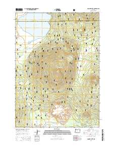
2014 Map of Hamner Butte
USGS Topo · Published 2014About this map
Davis Lake sits at the northern edge of this high-elevation landscape, where the waters are fed by Ranger Cr and flow out through Odell Cr. The terrain is defined by a series of prominent volcanic peaks including Hamner Butte, Saddle Butte, and Davis Mtn, which rise sharply above the Deschutes National Forest. This 2014 survey documents a complex network of forest development roads, such as Nat For Dev Rd 4600-855 and Nat For Dev Rd 4674, that provide access through the timbered slopes. The map also delineates the boundary between Deschutes Co and Klamath Co, while marking isolated water sources like Dell Spring and the winding course of Crescent Cr near Black Rock in the south.
Find a feature on this map
27 named features on this map. Tap any name to fly to it.
Don’t see what you’re looking for? This feature index may not catch every label — zoom into the map to look around manually.
Map Details
Editions of this 2014 Hamner Butte Map
This is the sole edition of this map. No revisions or reprints were ever made.
Other maps of this area

1930 · Maiden Peak
USGS Topo · 1:125,000

1934 · Maiden Peak
USGS Topo · 1:125,000

1935 · Chemult
USGS Topo · 1:96,000

1941 · Chemult
USGS Topo · 1:125,000

1955 · Crescent
USGS Topo · 1:250,000

1957 · Crescent
USGS Topo · 1:250,000

1958 · Crescent
USGS Topo · 1:250,000

1963 · Hamner Butte
USGS Topo · 1:24,000
1963 · The Twins
USGS Topo · 1:24,000
1963 · Odell Lake
USGS Topo · 1:24,000