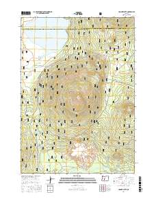
2017 Map of Hamner Butte
USGS Topo · Published 2017About this map
Hamner Butte and Saddle Butte dominate the central topography of this section of the Deschutes National Forest, where the volcanic landscape meets the drainage of the Deschutes Basin. In the northern reaches, the waters of Davis Lake are fed by Odell Cr and Ranger Cr, marking a critical hydrologic point near the Deschutes Co and Klamath Co line. The map reveals a complex network of forest development roads and specialized runs, such as the Hamner-Davis Run and Gilchrist Express, which suggest a landscape managed for both timber access and recreational transit. Further south, the terrain descends toward the marshes of Crescent Cr near the volcanic landmark of Black Rock, providing a clear view of the transition from high buttes to meadow-laced riparian corridors.
Find a feature on this map
31 named features on this map. Tap any name to fly to it.
Don’t see what you’re looking for? This feature index may not catch every label — zoom into the map to look around manually.
Map Details
Editions of this 2017 Hamner Butte Map
This is the sole edition of this map. No revisions or reprints were ever made.
Other maps of this area

1930 · Maiden Peak
USGS Topo · 1:125,000

1934 · Maiden Peak
USGS Topo · 1:125,000

1935 · Chemult
USGS Topo · 1:96,000

1941 · Chemult
USGS Topo · 1:125,000

1955 · Crescent
USGS Topo · 1:250,000

1957 · Crescent
USGS Topo · 1:250,000

1958 · Crescent
USGS Topo · 1:250,000

1963 · Hamner Butte
USGS Topo · 1:24,000
1963 · The Twins
USGS Topo · 1:24,000
1963 · Odell Lake
USGS Topo · 1:24,000