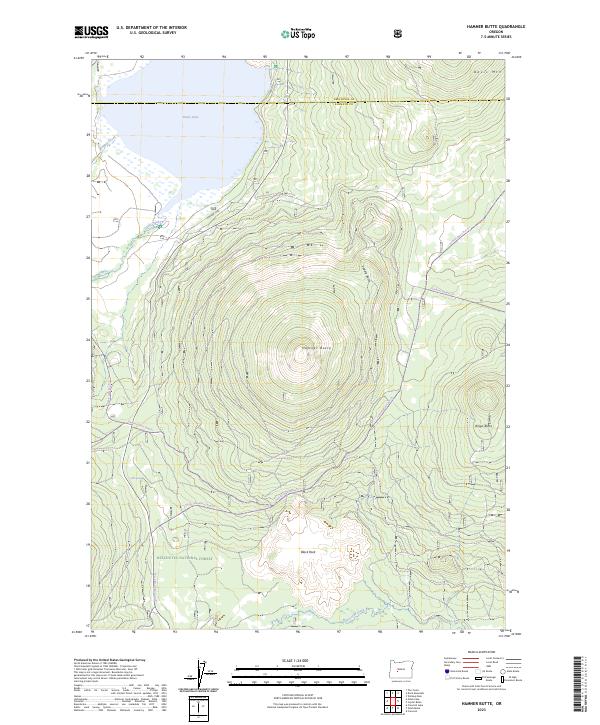
2023 Map of Hamner Butte
USGS Topo · Published 2023About this map
Hamner Butte dominates this high-elevation landscape within the Deschutes National Forest, where the volcanic terrain of the Cascades defines the drainage and transport patterns. To the north, Davis Lake is fed by Ranger Creek and Odell Creek, while the southern reaches are marked by the winding path of Crescent Creek. The boundary between Deschutes and Klamath counties cuts across the northern shoreline, an area where water resources like Dell Spring were essential for early forest navigation. The map shows a transition from motorized access along Co HWY 1352 to a network of specialized routes, including the Gilchrist Express Trl and the Royce Mountain Loop Trl, which follow the contours of the many shield-like peaks such as Saddle Butte and Ringo Butte.
Find a feature on this map
17 named features on this map. Tap any name to fly to it.
Don’t see what you’re looking for? This feature index may not catch every label — zoom into the map to look around manually.
Map Details
Editions of this 2023 Hamner Butte Map
This is the sole edition of this map. No revisions or reprints were ever made.
Other maps of this area

1930 · Maiden Peak
USGS Topo · 1:125,000

1934 · Maiden Peak
USGS Topo · 1:125,000

1935 · Chemult
USGS Topo · 1:96,000

1941 · Chemult
USGS Topo · 1:125,000

1955 · Crescent
USGS Topo · 1:250,000

1957 · Crescent
USGS Topo · 1:250,000

1958 · Crescent
USGS Topo · 1:250,000

1963 · Hamner Butte
USGS Topo · 1:24,000
1963 · The Twins
USGS Topo · 1:24,000
1963 · Odell Lake
USGS Topo · 1:24,000