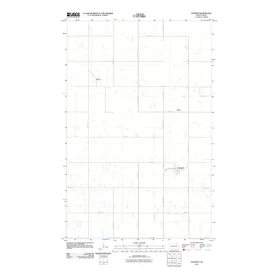
2011 Map of Hampden
USGS Topo · Published 2011About this map
Hampden serves as the primary hub of this North Dakota landscape, situated at the intersection of County Hwy-3 Main St and 93rd Ave NE. The town's layout follows a rigid grid that extends across the surrounding plains, where a series of numeric section roads like 83rd St NE and 89th Ave NE organize the agricultural territory. Genealogy and local history are anchored by the Storlie Cemetery located north of the town center along County Hwy-3, while the settlement of Weaver appears as a distinct point of interest to the northwest. Numerous small depressions and seasonal wetlands dot the sections, revealing the prairie pothole geography characteristic of this part of Cavalier County.
Find a feature on this map
18 named features on this map. Tap any name to fly to it.
Don’t see what you’re looking for? This feature index may not catch every label — zoom into the map to look around manually.
Map Details
Editions of this 2011 Hampden Map
This is the sole edition of this map. No revisions or reprints were ever made.
Other maps of this area

1953 · Devils Lake
USGS Topo · 1:250,000

1956 · Devils Lake
USGS Topo · 1:250,000

1962 · Starkweather NE
USGS Topo · 1:24,000

1970 · Alsen
USGS Topo · 1:24,000

1970 · Loma
USGS Topo · 1:24,000

1970 · Alsen SE
USGS Topo · 1:24,000

1970 · Hampden
USGS Topo · 1:24,000

1970 · Munich
USGS Topo · 1:24,000

1971 · Munich SE
USGS Topo · 1:24,000

1972 · Derrick NW
USGS Topo · 1:24,000