
1970 Map of Loma
USGS Topo · Published 1972About this map
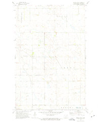
The prairie landscape of Cavalier County is defined here by the small community of Loma, centered around the Soo Line tracks. This 1970 survey reveals a rural infrastructure of townships like Waterloo and North Loma, where section lines and farmstead boundaries are marked by fences visible from aerial photography. The spiritual and civic life of these remote townships is anchored by the Bethel Ch, a local Cem, and a scattered Townhall. In the southern reaches of the quadrangle, the settlement of Storlie appears alongside the railroad, while several Gravel Pit operations indicate the local extractive industry. The terrain is characterized by numerous small potholes and wetlands common to this glaciated region of North Dakota, creating a complex drainage pattern across the agricultural fields.
Find a feature on this map
12 named features on this map. Tap any name to fly to it.
Don’t see what you’re looking for? This feature index may not catch every label — zoom into the map to look around manually.
Map Details
Editions of this 1970 Loma Map
This is the sole edition of this map. No revisions or reprints were ever made.
Other maps of this area

1953 · Devils Lake
USGS Topo · 1:250,000

1956 · Devils Lake
USGS Topo · 1:250,000

1970 · Alsen
USGS Topo · 1:24,000

1970 · Hannah SW
USGS Topo · 1:24,000

1970 · Alsen SE
USGS Topo · 1:24,000

1970 · Hannah SE
USGS Topo · 1:24,000

1970 · Hampden
USGS Topo · 1:24,000

1970 · Langdon West
USGS Topo · 1:24,000

1972 · Billings Lake
USGS Topo · 1:24,000
1972 · Nekoma NW
USGS Topo · 1:24,000