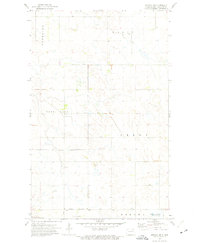
1972 Map of Nekoma NW
USGS Topo · Published 1975About this map
The landscape of Cavalier County is defined by a vast network of prairie potholes and conservation areas as they appeared in the early 1970s. This survey centers on the township boundaries of Waterloo, Elgin, North Loma, and Perry, revealing a rural infrastructure of section-line roads and scattered agricultural activity. Small-scale industrial traces like a Gravel Pit and Shale Pit are situated amidst the undulating terrain. A significant portion of the southern area is dedicated to wildlife conservation, notably within the Billings Lake National Wildlife Refuge and the National Waterfowl Production Area. The village of Loma is detailed by its Loma Corporate Boundary, providing a clear record of the town's footprint at the time of the 1972 field check. This map is essential for understanding the historical intersection of North Dakota agriculture and federal waterfowl management.
Find a feature on this map
12 named features on this map. Tap any name to fly to it.
Don’t see what you’re looking for? This feature index may not catch every label — zoom into the map to look around manually.
Map Details
Editions of this 1972 Nekoma NW Map
This is the sole edition of this map. No revisions or reprints were ever made.
Other maps of this area

1953 · Devils Lake
USGS Topo · 1:250,000

1956 · Devils Lake
USGS Topo · 1:250,000

1967 · Langdon East
USGS Topo · 1:24,000

1970 · Loma
USGS Topo · 1:24,000

1970 · Alsen SE
USGS Topo · 1:24,000

1970 · Hannah SE
USGS Topo · 1:24,000

1970 · Langdon West
USGS Topo · 1:24,000

1972 · Nekoma
USGS Topo · 1:24,000

1972 · Easby
USGS Topo · 1:24,000

1972 · Billings Lake
USGS Topo · 1:24,000