
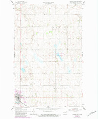
1967 Map of Langdon East
USGS Topo · Published 1969About this map
Langdon serves as the primary hub in this late-1960s survey of Cavalier County, anchored by the Great Northern railroad line cutting across the southwestern corner of the landscape. The town site is well-developed with local landmarks including the Fairground, a local Park, and the Lebanon Cem located just east of the main residential grid. Outside the immediate settlement, the terrain is defined by township boundaries like Harvey and Manilla, where the agricultural character of the region is punctuated by small community centers such as the Harvey Center Ch and Harvey Cem. Physical infrastructure including a Gravel Pit and prominent Radio Towers reflect the local economy and communications of the era, while the Country Club north of town highlights the social landscape of this North Dakota prairie community.
Find a feature on this map
16 named features on this map. Tap any name to fly to it.
Don’t see what you’re looking for? This feature index may not catch every label — zoom into the map to look around manually.
Map Details
Editions of this 1967 Langdon East Map
2 editions found
Other maps of this area

1953 · Devils Lake
USGS Topo · 1:250,000

1956 · Devils Lake
USGS Topo · 1:250,000

1967 · Maida
USGS Topo · 1:24,000

1969 · Olga SW
USGS Topo · 1:24,000

1969 · Olga NW
USGS Topo · 1:24,000

1970 · Mount Carmel
USGS Topo · 1:24,000

1970 · Langdon West
USGS Topo · 1:24,000

1972 · Osnabrock
USGS Topo · 1:24,000

1972 · Easby
USGS Topo · 1:24,000
1972 · Nekoma NW
USGS Topo · 1:24,000