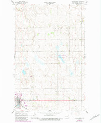
1967 Map of Langdon East
USGS Topo · Published 1984About this map
Langdon anchors the southwestern corner of this survey, illustrating the town's footprint as it appeared in the mid-1960s with updates through the early 1980s. The local economy and social life of Cavalier County are reflected in landmarks like the Drive-in Theater and the Country Club, while the Burlington Northern railroad corridor provides a vital link through the plains. To the north, the landscape is defined by the National Waterfowl Production Area, a series of wetlands and basins that contrast with the organized grid of surrounding townships including Harvey and Elgin. Genealogists may find interest in the Harvey Cem located in the eastern portion of the map, while industrial sites like the Gravel Pit near Manilla township mark the active use of local resources. This 1967 survey, later photorevised, documents the transition from early mid-century infrastructure to modern conservation and transportation patterns.
Find a feature on this map
14 named features on this map. Tap any name to fly to it.
Don’t see what you’re looking for? This feature index may not catch every label — zoom into the map to look around manually.
Map Details
Editions of this 1967 Langdon East Map
2 editions found
Other maps of this area

1953 · Devils Lake
USGS Topo · 1:250,000

1956 · Devils Lake
USGS Topo · 1:250,000

1967 · Langdon East
USGS Topo · 1:24,000

1967 · Maida
USGS Topo · 1:24,000

1969 · Olga SW
USGS Topo · 1:24,000

1969 · Olga NW
USGS Topo · 1:24,000

1970 · Mount Carmel
USGS Topo · 1:24,000

1970 · Langdon West
USGS Topo · 1:24,000

1972 · Osnabrock
USGS Topo · 1:24,000

1972 · Easby
USGS Topo · 1:24,000