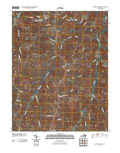
2010 Map of Hampden Sydney
USGS Topo · Published 2010About this map
Hampden Sydney serves as the focal point of this Prince Edward County landscape, where the historic college grounds are detailed with landmarks like Fraternity Circle and Penshurst Lawn. This area of Virginia is characterized by a network of waterways that define property and community boundaries, most notably the winding course of Briery Creek and the Bush River. The map documents a predominantly rural and academic environment, with small settlements like Worsham and Kingsville clustered near the college. Local history is deeply embedded in the land, evident in the numerous burial grounds such as Seminary Cemetery and New Wit Cemetery. The Presence of Providence Airport and roads like Roxbury Rd suggest the modern infrastructure connecting these long-standing communities, while water control features such as Sterling Lake Dam illustrate the local management of the region's aquatic resources.
Find a feature on this map
36 named features on this map. Tap any name to fly to it.
Don’t see what you’re looking for? This feature index may not catch every label — zoom into the map to look around manually.
Map Details
Editions of this 2010 Hampden Sydney Map
This is the sole edition of this map. No revisions or reprints were ever made.
Other maps of this area

1891 · Farmville
USGS Topo · 1:125,000

1892 · Appomattox
USGS Topo · 1:125,000

1893 · Farmville
USGS Topo · 1:125,000

1947 · Roanoke
USGS Topo · 1:250,000

1956 · Charlotte Court House
USGS Topo · 1:62,500

1958 · Farmville
USGS Topo · 1:62,500

1958 · Keysville
USGS Topo · 1:62,500

1958 · Pamplin City
USGS Topo · 1:62,500

1959 · Roanoke
USGS Topo · 1:250,000

1963 · Roanoke
USGS Topo · 1:250,000
Featured Places
- Hampden Sydney, VA
- Kingsville, Hampden Sydney
- Worsham, Hampden Sydney
- Prince Edward County, VA
- United States