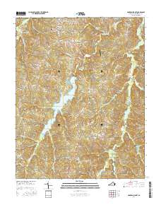
2016 Map of Hampden Sydney
USGS Topo · Published 2016About this map
Hampden - Sydney Coll and its historic academic core anchor this portion of Prince Edward County, where the village of Hampden Sydney connects to the surrounding landscape via Via Sacra and Wilson Trail. The survey reveals a region defined by its educational institutions and rural crossroads, including Kingsville and Worsham. The topography is shaped by the complex drainage of the Bush River and Briery Cr, which feeds into the sizable Sterling Lake in the southern half of the quadrangle. Local heritage is preserved in several rural burial grounds such as New Bethel Cem and Mount Pleasant Cem. In the northeastern corner, Providence Airport marks a modern utility amidst the agricultural and timbered lands. The map details a transition from the structured campus environment at the Seminary to the winding country routes like Darlington Heights Rd and Old Ridge Rd.
Find a feature on this map
80 named features on this map. Tap any name to fly to it.
Don’t see what you’re looking for? This feature index may not catch every label — zoom into the map to look around manually.
Map Details
Editions of this 2016 Hampden Sydney Map
This is the sole edition of this map. No revisions or reprints were ever made.
Other maps of this area

1891 · Farmville
USGS Topo · 1:125,000

1892 · Appomattox
USGS Topo · 1:125,000

1893 · Farmville
USGS Topo · 1:125,000

1947 · Roanoke
USGS Topo · 1:250,000

1956 · Charlotte Court House
USGS Topo · 1:62,500

1958 · Farmville
USGS Topo · 1:62,500

1958 · Keysville
USGS Topo · 1:62,500

1958 · Pamplin City
USGS Topo · 1:62,500

1959 · Roanoke
USGS Topo · 1:250,000

1963 · Roanoke
USGS Topo · 1:250,000
Featured Places
- Hampden Sydney, VA
- Kingsville, Hampden Sydney
- Worsham, Hampden Sydney
- Prince Edward County, VA
- United States