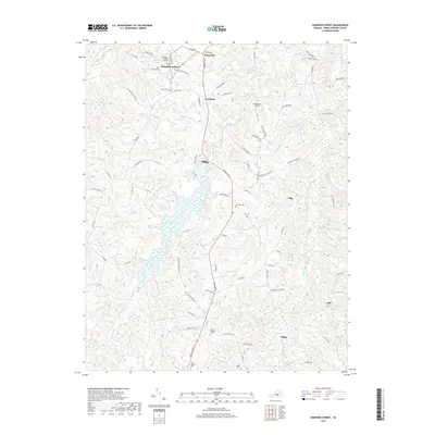
2019 Map of Hampden Sydney
USGS Topo · Published 2019About this map
Hampden Sydney College anchors this part of Prince Edward County, surrounded by a network of rural settlements including Kingsville, Worsham, and Poplar Hill. The landscape is defined by the significant reaches of Briery Creek and the Bush River, which are fed by numerous smaller tributaries like Little Buffalo Cr and Redd Br. Notable water bodies such as Chalgrove Lake and Sterling Lake punctuate the wooded terrain, while Leigh Mountain rises as a prominent landmark to the east.
Find a feature on this map
84 named features on this map. Tap any name to fly to it.
Don’t see what you’re looking for? This feature index may not catch every label — zoom into the map to look around manually.
Map Details
Editions of this 2019 Hampden Sydney Map
This is the sole edition of this map. No revisions or reprints were ever made.
Other maps of this area

1891 · Farmville
USGS Topo · 1:125,000

1892 · Appomattox
USGS Topo · 1:125,000

1893 · Farmville
USGS Topo · 1:125,000

1947 · Roanoke
USGS Topo · 1:250,000

1956 · Charlotte Court House
USGS Topo · 1:62,500

1958 · Farmville
USGS Topo · 1:62,500

1958 · Keysville
USGS Topo · 1:62,500

1958 · Pamplin City
USGS Topo · 1:62,500

1959 · Roanoke
USGS Topo · 1:250,000

1963 · Roanoke
USGS Topo · 1:250,000
Featured Places
- Hampden Sydney, VA
- Kingsville, Hampden Sydney
- Worsham, Hampden Sydney
- Prince Edward County, VA
- United States