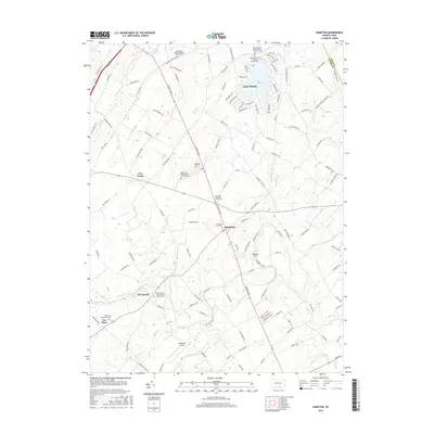
2016 Map of Hampton
USGS Topo · Published 2016About this map
Hampton and its surrounding rural townships are centered on the prominent Carlisle Pike, which bisects the landscape of central Pennsylvania. The area's deep sectarian roots are evident in the concentration of spiritual sites, including the Huntington Quaker Meeting House, Round Hill Presbyterian Church, and several Lutheran and United Church of Christ locations. These congregations and their associated burial grounds, such as the Hampton Meeting House Cem, suggest a history of early European settlement along the drainage basins of Bermudian Cr and Conewago Creek. To the north, the residential development surrounding Lake Meade provides a distinct contrast to the more traditional farmsteads and crossroads like Five Points and Newchester. Notable landmarks including Lamberson Airport and the historic York Sulphur Springs add to the character of this part of Adams County.
Find a feature on this map
134 named features on this map. Tap any name to fly to it.
Don’t see what you’re looking for? This feature index may not catch every label — zoom into the map to look around manually.
Map Details
Editions of this 2016 Hampton Map
This is the sole edition of this map. No revisions or reprints were ever made.
Other maps of this area

1904 · Carlisle
USGS Topo · 1:62,500

1906 · New Cumberland
USGS Topo · 1:62,500

1908 · Gettysburg
USGS Topo · 1:62,500

1920 · Hanover
USGS Topo · 1:62,500

1922 · Hanover
USGS Topo · 1:62,500

1942 · Gettysburg
USGS Topo · 1:125,000

1943 · New Cumberland
USGS Topo · 1:62,500

1943 · Carlisle
USGS Topo · 1:62,500

1944 · Gettysburg
USGS Topo · 1:31,680

1944 · Mc Sherrystown
USGS Topo · 1:31,680
Featured Places
- Latimore Township, PA
- Reading Township, PA
- Tyrone Township, PA
- Hamilton Township, PA
- Oxford Township, PA