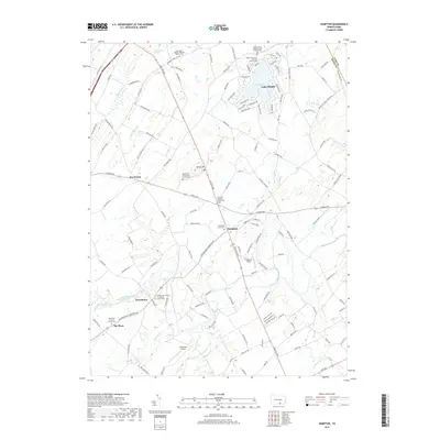
2019 Map of Hampton
USGS Topo · Published 2019About this map
Lake Meade and the surrounding drainage basins of the Bermudian Cr and Conewago Creek define this agricultural and residential landscape in Adams County. The settlement patterns reflect deep religious and communal roots, evidenced by an exceptional concentration of burial grounds and houses of worship. From the Huntington Quaker Meeting House Cem in the north to the Saint Paul Lutheran Church Cem at The Pines, the map preserves the locations of early congregations. The Carlisle Pike serves as a primary transit corridor, linking the village of Hampton with Round Hill and York Sulphur Springs. Local aviation history is also marked by the presence of Lamberson Airport near the South Branch Conewago Creek, while the confluence of rural roads like Tape Worm Rd and Dicks Dam Rd indicates the area's transition from early milling and dam sites to modern rural residential use.
Find a feature on this map
135 named features on this map. Tap any name to fly to it.
Don’t see what you’re looking for? This feature index may not catch every label — zoom into the map to look around manually.
Map Details
Editions of this 2019 Hampton Map
This is the sole edition of this map. No revisions or reprints were ever made.
Other maps of this area

1904 · Carlisle
USGS Topo · 1:62,500

1906 · New Cumberland
USGS Topo · 1:62,500

1908 · Gettysburg
USGS Topo · 1:62,500

1920 · Hanover
USGS Topo · 1:62,500

1922 · Hanover
USGS Topo · 1:62,500

1942 · Gettysburg
USGS Topo · 1:125,000

1943 · New Cumberland
USGS Topo · 1:62,500

1943 · Carlisle
USGS Topo · 1:62,500

1944 · Gettysburg
USGS Topo · 1:31,680

1944 · Mc Sherrystown
USGS Topo · 1:31,680
Featured Places
- Latimore Township, PA
- Reading Township, PA
- Tyrone Township, PA
- Hamilton Township, PA
- Oxford Township, PA