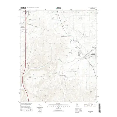
2014 Map of Hanceville
USGS Topo · Published 2014About this map
The George C Wallace State Community College-Hanceville serves as a prominent anchor in this area of Cullman County, situated just west of the residential and commercial streets of Hanceville. The terrain is characterized by a series of significant heights, including Stout Mtn, Buttermilk Mtn, and Garden City Mtn, which frame the various creek valleys. Numerous small settlements and rural junctions like White City, Johnsons Crossing, and Dodge City are connected by an intricate network of county roads. For those researching local heritage, several community burial grounds are documented, such as Laodicea Cem, Hopewell Cem, and Mtn Grove Cem. Waterways like Mud Cr and Thacker Cr wind through the valleys, illustrating the drainage patterns that have historically influenced the placement of farms and small communities throughout the region.
Find a feature on this map
132 named features on this map. Tap any name to fly to it.
Don’t see what you’re looking for? This feature index may not catch every label — zoom into the map to look around manually.
Map Details
Editions of this 2014 Hanceville Map
This is the sole edition of this map. No revisions or reprints were ever made.
Other maps of this area

1888 · Cullman
USGS Topo · 1:125,000

1889 · Birmingham
USGS Topo · 1:125,000

1892 · Cullman
USGS Topo · 1:125,000

1892 · Birmingham
USGS Topo · 1:125,000

1895 · Birmingham
USGS Topo · 1:125,000

1907 · Birmingham
USGS Topo · 1:125,000

1951 · Arkadelphia
USGS Topo · 1:24,000

1951 · Blount Springs
USGS Topo · 1:24,000

1953 · Birmingham
USGS Topo · 1:250,000

1956 · Birmingham
USGS Topo · 1:250,000