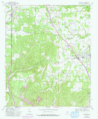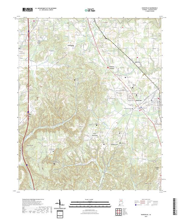
2024 Map of Hanceville
USGS Topo · Published 2024About this map
Hanceville and its surrounding communities in Cullman County are depicted in this 2024 survey, which reveals a landscape of upland ridges and scattered cemeteries. The modern development of Wallace State Community College stands as a central institutional landmark, while the rural character of the area is preserved in numerous family burial grounds such as Edwards Family Cem Number One and Williams Family Cem. The terrain is defined by prominent elevations including Buttermilk Mtn, Stout Mtn, and Garden City Mtn, which overlook the winding course of Thacker Creek and Marriott Creek.
Find a feature on this map
163 named features on this map. Tap any name to fly to it.
Don’t see what you’re looking for? This feature index may not catch every label — zoom into the map to look around manually.
Map Details
Editions of this 2024 Hanceville Map
This is the sole edition of this map. No revisions or reprints were ever made.