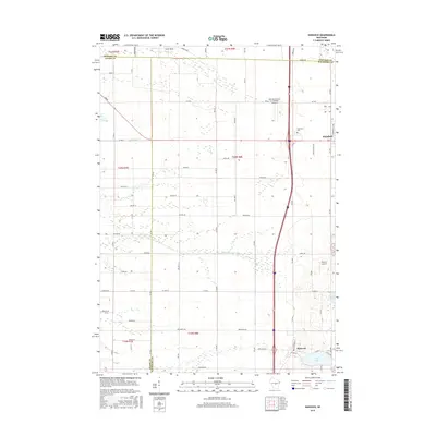
2015 Map of Hancock
USGS Topo · Published 2015About this map
The villages of Hancock and Plainfield anchor this central Wisconsin landscape, which is marked by a sophisticated network of drainage and local transit systems. The central corridor is dominated by the north-south transport artery, while the surrounding area is characterized by a high concentration of named rural roads, including Beechnut Ave and Aniwa Dr. Water management is evident through the Leola Ditch in the northwest, which works alongside natural features like the Big Roche a Cri Cr. Local aviation is represented by two distinct facilities: Runway Leasing Inc Number 1 Airport near the northern boundary and Bucky's Airpark to the south. For those interested in local history and genealogy, the Plainfield Cem is clearly identified, and the map shows the exact meeting points of three counties: Adams, Portage, and Waushara. Natural landmarks such as Lone Rock and water bodies like Goose Lake and Pine Lake provide additional context for the region's topographical character.
Find a feature on this map
62 named features on this map. Tap any name to fly to it.
Don’t see what you’re looking for? This feature index may not catch every label — zoom into the map to look around manually.
Map Details
Editions of this 2015 Hancock Map
This is the sole edition of this map. No revisions or reprints were ever made.
Other maps of this area

1955 · Green Bay
USGS Topo · 1:250,000

1957 · Amherst
USGS Topo · 1:48,000

1957 · Whiting
USGS Topo · 1:48,000

1958 · Coloma
USGS Topo · 1:48,000

1959 · Wautoma
USGS Topo · 1:48,000

1968 · Coloma NW
USGS Topo · 1:24,000

1968 · Coloma SW
USGS Topo · 1:24,000

1968 · Coloma
USGS Topo · 1:24,000

1968 · Richford
USGS Topo · 1:24,000

1968 · Plainfield
USGS Topo · 1:24,000