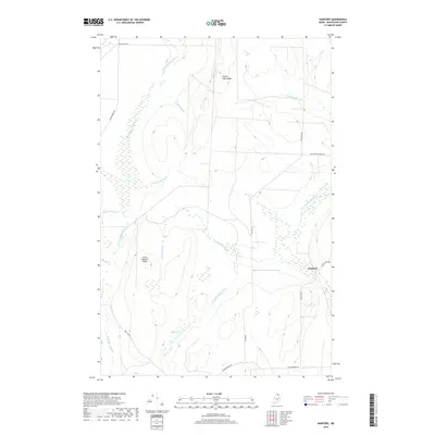
2018 Map of Hanford
USGS Topo · Published 2018About this map
Hanford sits at the intersection of forest and waterway in this Aroostook County landscape, where the Little Madawaska River winds through a terrain defined by significant drainage networks. The settlement patterns follow the ridges and brooks, with Square Lake Ridge and Little Goddard Ridge providing high ground above the numerous wetlands and small streams. The local road network, including Blackstone Siding Rd and Tangle Ridge Rd, suggests a landscape shaped by the logging or agricultural industries of northern Maine.
Find a feature on this map
22 named features on this map. Tap any name to fly to it.
Don’t see what you’re looking for? This feature index may not catch every label — zoom into the map to look around manually.
Map Details
Editions of this 2018 Hanford Map
This is the sole edition of this map. No revisions or reprints were ever made.
Other maps of this area

1927 · Stockholm
USGS Topo · 1:48,000

1927 · Square Lake
USGS Topo · 1:48,000

1929 · Portage
USGS Topo · 1:62,500

1929 · Caribou
USGS Topo · 1:48,000

1931 · Square Lake
USGS Topo · 1:62,500

1931 · Portage
USGS Topo · 1:62,500

1931 · Stockholm
USGS Topo · 1:62,500

1932 · Caribou
USGS Topo · 1:62,500

1953 · Stockholm
USGS Topo · 1:62,500

1953 · Square Lake
USGS Topo · 1:62,500