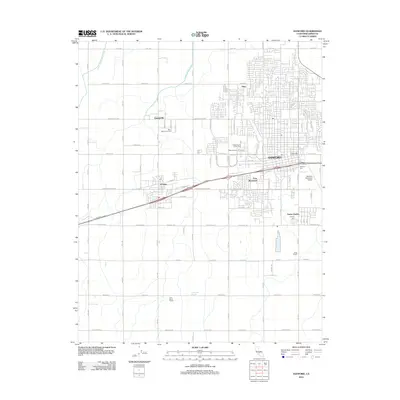
2012 Map of Hanford
USGS Topo · Published 2012About this map
Agricultural development and civic expansion define this Central Valley landscape, centered on the city of Hanford and its neighboring communities. The map highlights distinct cultural landmarks such as China Alley, reflecting the local heritage, alongside the regional Hanford Municipal Airport. Water management remains vital to the area's identity, evidenced by the Lower Kings River Ditch and Last Chance Ditch that irrigate the surrounding plains.
Find a feature on this map
36 named features on this map. Tap any name to fly to it.
Don’t see what you’re looking for? This feature index may not catch every label — zoom into the map to look around manually.
Map Details
Editions of this 2012 Hanford Map
This is the sole edition of this map. No revisions or reprints were ever made.
Other maps of this area

1924 · Riverdale
USGS Topo · 1:31,680

1926 · Hanford
USGS Topo · 1:31,680

1926 · Burris Park
USGS Topo · 1:31,680

1927 · Laton
USGS Topo · 1:31,680

1927 · Remnoy
USGS Topo · 1:31,680

1927 · Riverdale
USGS Topo · 1:31,680

1927 · Lemoore
USGS Topo · 1:31,680

1928 · Waukena
USGS Topo · 1:31,680

1929 · Guernsey
USGS Topo · 1:31,680

1929 · Stratford
USGS Topo · 1:31,680