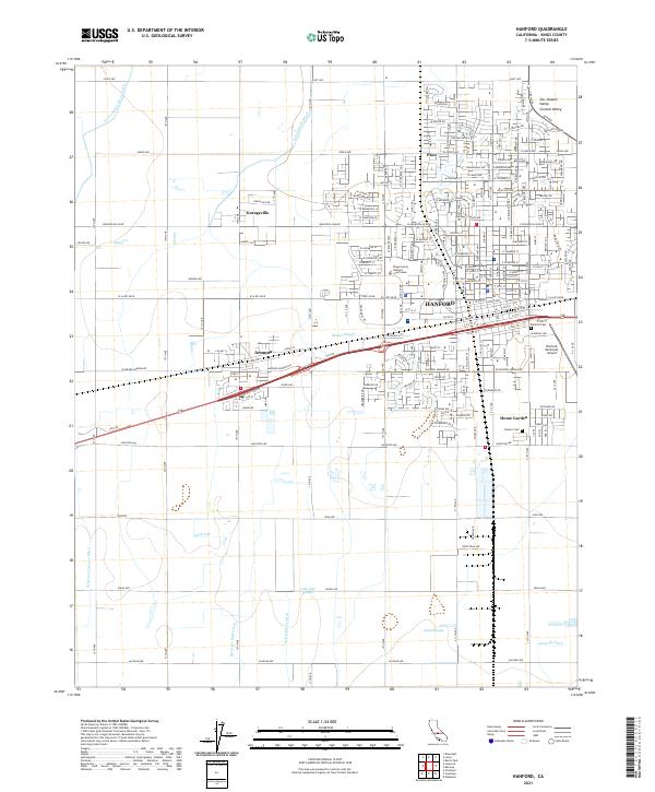
2021 Map of Hanford
USGS Topo · Published 2021About this map
The agricultural landscape of the San Joaquin Valley is defined by a complex network of irrigation infrastructure surrounding the city of Hanford. This 2021 survey details the intricate system of ditches and sloughs, such as Mussel Slough, Lower Kings River Ditch, and Lakeside Ditch, that sustain the region's productivity. The map captures the interface between urban expansion and rural tradition, from the dense street grids of Home Garden and the Kings County Hanford Courthouse to the outlying community of Grangeville.
Find a feature on this map
41 named features on this map. Tap any name to fly to it.
Don’t see what you’re looking for? This feature index may not catch every label — zoom into the map to look around manually.
Map Details
Editions of this 2021 Hanford Map
This is the sole edition of this map. No revisions or reprints were ever made.
Other maps of this area

1924 · Riverdale
USGS Topo · 1:31,680

1926 · Hanford
USGS Topo · 1:31,680

1926 · Burris Park
USGS Topo · 1:31,680

1927 · Laton
USGS Topo · 1:31,680

1927 · Remnoy
USGS Topo · 1:31,680

1927 · Riverdale
USGS Topo · 1:31,680

1927 · Lemoore
USGS Topo · 1:31,680

1928 · Waukena
USGS Topo · 1:31,680

1929 · Guernsey
USGS Topo · 1:31,680

1929 · Stratford
USGS Topo · 1:31,680