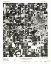
1976 Map of Hanford
USGS Topo · Published 1980About this map
Hanford serves as the primary urban center for this mid-1970s orthophoto quadrangle, showing the distinct density of the city's residential and commercial grid against the surrounding agricultural expanse of the San Joaquin Valley. The high-contrast aerial imagery captures the sharp boundary where the developed streets of Hanford meet the massive, geometric patchwork of cultivated fields. To the west, the smaller community of Armona sits along the rail and highway corridor, while Grangeville appears as a small cluster at the northern edge of this irrigation-dependent landscape. The dominance of large-scale farming is evident in the sprawling, dark-toned acreage that fills the majority of the sheet, intersected by the straight lines of rural roads and State Route 198. This specialized view provides researchers a clear look at the precise layout of Kings County orchards and row crops during a period of significant agricultural production.
Find a feature on this map
4 named features on this map. Tap any name to fly to it.
Don’t see what you’re looking for? This feature index may not catch every label — zoom into the map to look around manually.
Map Details
Editions of this 1976 Hanford Map
This is the sole edition of this map. No revisions or reprints were ever made.
Other maps of this area

1924 · Riverdale
USGS Topo · 1:31,680

1926 · Hanford
USGS Topo · 1:31,680

1926 · Burris Park
USGS Topo · 1:31,680

1927 · Laton
USGS Topo · 1:31,680

1927 · Remnoy
USGS Topo · 1:31,680

1927 · Riverdale
USGS Topo · 1:31,680

1927 · Lemoore
USGS Topo · 1:31,680

1928 · Waukena
USGS Topo · 1:31,680

1929 · Guernsey
USGS Topo · 1:31,680

1929 · Stratford
USGS Topo · 1:31,680