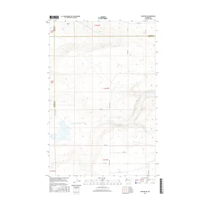
2017 Map of Hanford NE
USGS Topo · Published 2017About this map
Wahluke Slope defines the northern reaches of this high desert landscape, falling away toward the irrigation infrastructure that transformed this region of Washington. The presence of the Wahluke Br Ten Wasteway illustrates the complex water management system essential to local agriculture, channeling runoff across the arid terrain. The map captures a transition point where Grant, Adams, and Franklin counties meet, marked by a rigid grid of rural access roads including Mountain Vista Rd and Michel Rd. These routes, along with the Wahluke Pond Trail, provide a window into the modern land use of the Hanford area, balancing industrial-scale water transport with recreational and agricultural access in a historically significant corner of the Pacific Northwest.
Find a feature on this map
23 named features on this map. Tap any name to fly to it.
Don’t see what you’re looking for? This feature index may not catch every label — zoom into the map to look around manually.
Map Details
Editions of this 2017 Hanford NE Map
This is the sole edition of this map. No revisions or reprints were ever made.
Other maps of this area

1923 · Corfu
USGS Topo · 1:62,500

1924 · Othello
USGS Topo · 1:62,500

1924 · Hanford
USGS Topo · 1:62,500

1925 · Scooteney Lake
USGS Topo · 1:62,500

1951 · Scooteney Lake
USGS Topo · 1:62,500

1951 · Corfu
USGS Topo · 1:62,500

1951 · Hanford
USGS Topo · 1:62,500

1953 · Walla Walla
USGS Topo · 1:250,000

1954 · Othello
USGS Topo · 1:24,000

1954 · Othello
USGS Topo · 1:62,500