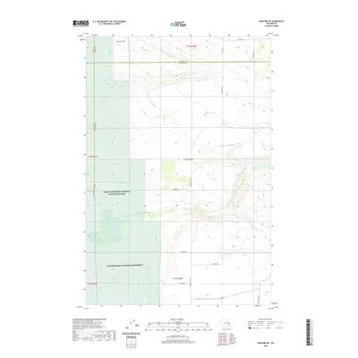
2020 Map of Hanford NE
USGS Topo · Published 2020About this map
Saddle Mountain National Wildlife Refuge and the Hanford Reach National Monument occupy the southwestern portions of this landscape, representing a significant conservation buffer in the Columbia Basin. The terrain is defined by the Wahluke Slope, which descends toward a sophisticated network of irrigation infrastructure essential to the region's agricultural history. The Wahluke Branch Canal snakes across the northern sections, feeding into secondary systems like the Wahluke Br Ten Wasteway and Wahluke Br Ten-A Wasteway. This intricate water management system is countered by a rigid grid of rural roads, including Mountain Vista Rd and Koelzer Rd, which serve the agricultural parcels that dominate the eastern and northern reaches of the quadrangle. For hikers and naturalists, the Wahluke Pond Trail provides a rare point of access into the protected shrub-steppe environment near the wildlife refuge boundary.
Find a feature on this map
26 named features on this map. Tap any name to fly to it.
Don’t see what you’re looking for? This feature index may not catch every label — zoom into the map to look around manually.
Map Details
Editions of this 2020 Hanford NE Map
This is the sole edition of this map. No revisions or reprints were ever made.
Other maps of this area

1923 · Corfu
USGS Topo · 1:62,500

1924 · Othello
USGS Topo · 1:62,500

1924 · Hanford
USGS Topo · 1:62,500

1925 · Scooteney Lake
USGS Topo · 1:62,500

1951 · Scooteney Lake
USGS Topo · 1:62,500

1951 · Corfu
USGS Topo · 1:62,500

1951 · Hanford
USGS Topo · 1:62,500

1953 · Walla Walla
USGS Topo · 1:250,000

1954 · Othello
USGS Topo · 1:24,000

1954 · Othello
USGS Topo · 1:62,500