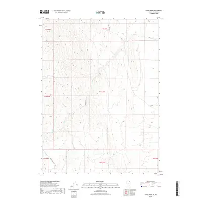
2018 Map of Hanks Creek NE
USGS Topo · Published 2018About this map
Hanks Cr and its tributaries define the drainage patterns of this high-elevation corner of Elko County, where cattle ranching and seasonal grazing continue to shape the landscape. The presence of Marys Creek Ranch in the northern reaches, alongside water sources like Union Spring Three, illustrates the ongoing importance of reliable water in the Nevada high desert. The transportation network is minimal, dominated by unpaved routes such as Hanks Creek Rd and the Charleston-Deeth Rd, which connect these remote holdings to distant regional hubs. This survey provides a precise view of the Public Land Survey System grid across multiple townships, tracing the rugged topography from Conners Cr to the headwaters of South Fork Hanks Cr.
Find a feature on this map
14 named features on this map. Tap any name to fly to it.
Don’t see what you’re looking for? This feature index may not catch every label — zoom into the map to look around manually.
Map Details
Editions of this 2018 Hanks Creek NE Map
This is the sole edition of this map. No revisions or reprints were ever made.
Other maps of this area

1955 · Wells
USGS Topo · 1:250,000

1958 · Wells
USGS Topo · 1:250,000

1961 · Wells
USGS Topo · 1:250,000

1967 · Hanks Creek SW
USGS Topo · 1:24,000

1967 · Black Butte SW
USGS Topo · 1:24,000

1967 · Hot Springs Creek
USGS Topo · 1:24,000

1967 · Stag Mountain
USGS Topo · 1:24,000

1967 · Buena Vista Ranch
USGS Topo · 1:24,000

1967 · Hanks Creek NE
USGS Topo · 1:24,000

1968 · Charleston Reservoir
USGS Topo · 1:24,000