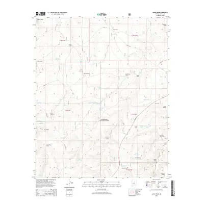
2014 Map of Hanks Draw
USGS Topo · Published 2014About this map
Sitgreaves National Forest covers much of this high-plateau region of Navajo County, defined by a complex system of drainage draws and canyons. The landscape is heavily marked by water management features essential for ranching and forest operations, including the Little Nelson Lake, the remote Wildcat Spring, and numerous named water tanks like Sponseller Tank and Wheelbarrow Tank. These catchments are often located at the heads of significant geological depressions such as Potato Field Draw and Hanks Draw. Transport through the area is anchored by State Hwy 260, which cuts through the southern terrain near Saloon Canyon. The naming conventions found on the map, from Stermer Ridge to Purcell Draw, reflect the early ranching families and homesteaders who utilized these remote forest lands before modern highway access.
Find a feature on this map
62 named features on this map. Tap any name to fly to it.
Don’t see what you’re looking for? This feature index may not catch every label — zoom into the map to look around manually.
Map Details
Editions of this 2014 Hanks Draw Map
This is the sole edition of this map. No revisions or reprints were ever made.
Other maps of this area

1886 · Holbrook
USGS Topo · 1:250,000

1893 · Holbrook
USGS Topo · 1:250,000

1954 · Holbrook
USGS Topo · 1:250,000

1957 · Holbrook
USGS Topo · 1:250,000

1958 · Holbrook
USGS Topo · 1:250,000

1960 · Holbrook
USGS Topo · 1:250,000

1961 · Woods Canyon
USGS Topo · 1:62,500

1961 · Heber
USGS Topo · 1:62,500

1965 · Chevelon Crossing
USGS Topo · 1:24,000

1970 · Red Knoll
USGS Topo · 1:24,000