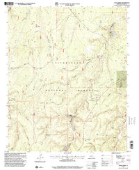
1998 Map of Hanks Draw
USGS Topo · Published 2000About this map
Sitgreaves National Forest dominates this high-altitude landscape in the late twentieth century, characterized by a complex network of canyons and draws that define the local drainage patterns. Private landholdings like Wyrick Ranch and Walnut Ranch are situated among these natural features, reflecting the era's ranching operations. The infrastructure for water management is highly visible, with dozens of named water features such as Little Nelson Lake, Dolphin Tank, and Wildcat Spring distributed across the terrain to support livestock and wildlife in this arid environment.
Find a feature on this map
66 named features on this map. Tap any name to fly to it.
Don’t see what you’re looking for? This feature index may not catch every label — zoom into the map to look around manually.
Map Details
Editions of this 1998 Hanks Draw Map
This is the sole edition of this map. No revisions or reprints were ever made.
Other maps of this area

1886 · Holbrook
USGS Topo · 1:250,000

1893 · Holbrook
USGS Topo · 1:250,000

1954 · Holbrook
USGS Topo · 1:250,000

1957 · Holbrook
USGS Topo · 1:250,000

1958 · Holbrook
USGS Topo · 1:250,000

1960 · Holbrook
USGS Topo · 1:250,000

1961 · Woods Canyon
USGS Topo · 1:62,500

1961 · Heber
USGS Topo · 1:62,500

1965 · Chevelon Crossing
USGS Topo · 1:24,000

1970 · Red Knoll
USGS Topo · 1:24,000