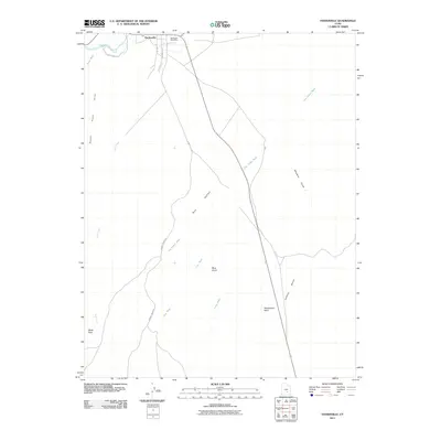
2011 Map of Hanksville
USGS Topo · Published 2011About this map
Hanksville serves as the focal point of this arid Wayne County landscape, situated at the confluence of the Fremont River and Sand Wash. The 2011 survey details the core of the settlement, including the Hanksville Post Office and local streets such as S Center St and Locust Ln. South of the town, the topography becomes dominated by the vast drainage systems of Bull Creek and Dry Valley, the latter of which stretches through the expansive Dry Valley itself. The map provides a clear look at the region's transport network before more recent developments, showing the winding path of Sawmill Basin Rd as it tracks through the washes. High ground is marked by distinct landmarks such as Blue Knoll, Penitentiary Point, and the South Pinto Hills, which define the western and southern horizons of this high-desert environment.
Find a feature on this map
19 named features on this map. Tap any name to fly to it.
Don’t see what you’re looking for? This feature index may not catch every label — zoom into the map to look around manually.
Map Details
Editions of this 2011 Hanksville Map
This is the sole edition of this map. No revisions or reprints were ever made.
Other maps of this area

1885 · San Rafael
USGS Topo · 1:250,000

1952 · Mt. Ellen 4 NW
USGS Topo · 1:24,000

1952 · Bull Mountain
USGS Topo · 1:62,500

1954 · Mt. Ellen 2 SE
USGS Topo · 1:24,000

1954 · Mt. Ellen 1 NW
USGS Topo · 1:24,000

1954 · Mt. Ellen 2 NE
USGS Topo · 1:24,000

1954 · Mt. Ellen 1 SW
USGS Topo · 1:24,000

1954 · Factory Butte
USGS Topo · 1:62,500

1956 · Salina
USGS Topo · 1:250,000

1960 · Salina
USGS Topo · 1:250,000