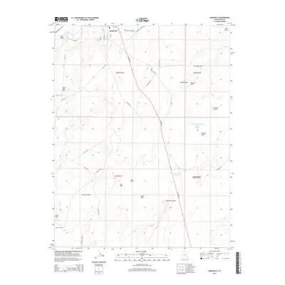
2014 Map of Hanksville
USGS Topo · Published 2014About this map
Hanksville serves as the central hub of this desert landscape, situated at the confluence of the Fremont River and Bull Cr. The map details the village's layout, including the Po and a network of local streets like S Center St and S 100 E. Beyond the settlement, the terrain transitions into the vast San Rafael Desert to the east and the South Pinto Hills to the west. This area is defined by its complex drainage systems, featuring numerous ephemeral washes such as Dry Valley Wash and Collie Wash. These hydrological patterns dictate the local infrastructure, with man-made water management features like Beef Hollow Reservoir, Step Reservoir, and Meadow Gulch Reservoir scattered across the high desert benches. The map also records the surrounding landmarks used for navigation, from the prominent Blue Knoll to the sharply defined Penitentiary Point.
Find a feature on this map
41 named features on this map. Tap any name to fly to it.
Don’t see what you’re looking for? This feature index may not catch every label — zoom into the map to look around manually.
Map Details
Editions of this 2014 Hanksville Map
This is the sole edition of this map. No revisions or reprints were ever made.
Other maps of this area

1885 · San Rafael
USGS Topo · 1:250,000

1952 · Mt. Ellen 4 NW
USGS Topo · 1:24,000

1952 · Bull Mountain
USGS Topo · 1:62,500

1954 · Mt. Ellen 2 SE
USGS Topo · 1:24,000

1954 · Mt. Ellen 1 NW
USGS Topo · 1:24,000

1954 · Mt. Ellen 2 NE
USGS Topo · 1:24,000

1954 · Mt. Ellen 1 SW
USGS Topo · 1:24,000

1954 · Factory Butte
USGS Topo · 1:62,500

1956 · Salina
USGS Topo · 1:250,000

1960 · Salina
USGS Topo · 1:250,000