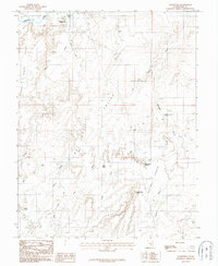
1987 Map of Hanksville
USGS Topo · Published 1987About this map
Hanksville serves as the focal point of this 1980s provisional study, situated where the Fremont River meets the confluence of various desert drainages. The settlement's layout includes a localized Trailer Park and a Footbridge crossing the river, reflecting the modest infrastructure of this Wayne County outpost. The surrounding terrain is defined by dramatic elevation changes, notably the Pinto Hills to the west and the expansive Halfway Bench to the southeast. Water management in this arid environment is evident through several named catchments, such as Meadow Gulch Reservoir and Beef Hollow Reservoir. The map documents a network of unimproved tracks like the Basin Road, which navigate the complex topography of South Valley and Dry Wash. Local landmarks like Penitentiary Point and White Point provide fixed navigational aids across the dissected plateaus and seasonal washes that dominate the landscape.
Find a feature on this map
23 named features on this map. Tap any name to fly to it.
Don’t see what you’re looking for? This feature index may not catch every label — zoom into the map to look around manually.
Map Details
Editions of this 1987 Hanksville Map
This is the sole edition of this map. No revisions or reprints were ever made.
Other maps of this area

1885 · San Rafael
USGS Topo · 1:250,000

1952 · Mt. Ellen 4 NW
USGS Topo · 1:24,000

1952 · Bull Mountain
USGS Topo · 1:62,500

1954 · Mt. Ellen 2 SE
USGS Topo · 1:24,000

1954 · Mt. Ellen 1 NW
USGS Topo · 1:24,000

1954 · Mt. Ellen 2 NE
USGS Topo · 1:24,000

1954 · Mt. Ellen 1 SW
USGS Topo · 1:24,000

1954 · Factory Butte
USGS Topo · 1:62,500

1956 · Salina
USGS Topo · 1:250,000

1960 · Salina
USGS Topo · 1:250,000