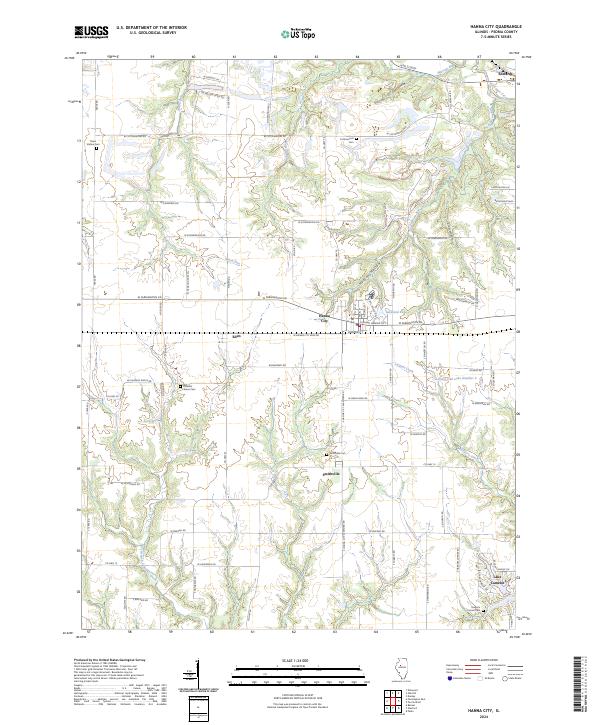
2024 Map of Hanna City
USGS Topo · Published 2024About this map
Hanna City sits at the heart of this central Illinois landscape, where the flat upland prairie begins to break into the wooded drainages of Kickapoo Creek and Largent Creek. The settlement pattern is defined by a rigid grid of country roads, including Texas Rd and N Eden Rd, which connects the smaller community of Eden to the larger village. To the south, Lake Camelot and Leisure Oak Lake Number 2 represent more recent residential developments that contrast with the traditional agricultural layout of the surrounding townships.
Find a feature on this map
79 named features on this map. Tap any name to fly to it.
Don’t see what you’re looking for? This feature index may not catch every label — zoom into the map to look around manually.
Map Details
Editions of this 2024 Hanna City Map
This is the sole edition of this map. No revisions or reprints were ever made.
Other maps of this area

1893 · Dunlap
USGS Topo · 1:62,500

1898 · Dunlap
USGS Topo · 1:62,500

1905 · Peoria
USGS Topo · 1:62,500

1927 · Peoria
USGS Topo · 1:62,500

1930 · Glasford
USGS Topo · 1:62,500

1932 · Dunlap
USGS Topo · 1:62,500

1933 · Dunlap
USGS Topo · 1:62,500

1937 · Dunlap
USGS Topo · 1:62,500

1944 · Elmwood
USGS Topo · 1:62,500

1948 · Elmwood
USGS Topo · 1:62,500