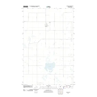
2011 Map of Hannah
USGS Topo · Published 2011About this map
Hannah sits at the northern edge of this North Dakota landscape, a small prairie settlement organized around a grid of streets including 1st St and 3rd Ave. Just outside the town limits, the Hannah Cemetery provides a focal point for genealogical research, while the surrounding terrain is defined by a sparse network of section-line roads such as 109th St NE and 91st Ave NE. The most prominent natural feature is Rush Lake, a large body of water that serves as a landmark in this high plains region. Flowing near the eastern boundary, Snowflake Creek meanders through the farmland, illustrating the drainage patterns of the northern borderlands. The map details the local infrastructure, including Lake Rd leading toward the water, reflecting the rural character of Cavalier County at the start of the second decade of the 2000s.
Find a feature on this map
26 named features on this map. Tap any name to fly to it.
Don’t see what you’re looking for? This feature index may not catch every label — zoom into the map to look around manually.
Map Details
Editions of this 2011 Hannah Map
This is the sole edition of this map. No revisions or reprints were ever made.
Other maps of this area

1953 · Devils Lake
USGS Topo · 1:250,000

1956 · Devils Lake
USGS Topo · 1:250,000

1970 · Sarles NE
USGS Topo · 1:24,000

1970 · Sarles SE
USGS Topo · 1:24,000

1970 · Hannah SW
USGS Topo · 1:24,000

1970 · Wales
USGS Topo · 1:24,000

1970 · Hannah
USGS Topo · 1:24,000

1970 · Hannah SE
USGS Topo · 1:24,000

1985 · Langdon
USGS Topo · 1:100,000
2011 · Hannah SW
USGS Topo · 1:24,000