
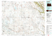
1985 Map of Langdon
USGS Topo · Published 1985About this map
Langdon serves as the central hub for this corner of northeastern North Dakota in the mid-1980s, where a grid of rural agricultural roads connects small grain-handling settlements across the prairie. The landscape is defined by its vast conservation areas and water management sites, including numerous plots of the National Waterfowl Production Area and the Billings Lake National Wildlife Refuge. To the east, the terrain transitions into the Pembina Hills, where the Pembina River and Tongue River have carved more defined valleys through the glacial drift.
Find a feature on this map
60 named features on this map. Tap any name to fly to it.
Don’t see what you’re looking for? This feature index may not catch every label — zoom into the map to look around manually.
Map Details
Editions of this 1985 Langdon Map
2 editions found
Other maps of this area

1918 · Walhalla
USGS Topo · 1:62,500

1943 · Walhalla
USGS Topo · 1:62,500

1952 · Thief River Falls
USGS Topo · 1:250,000

1953 · Devils Lake
USGS Topo · 1:250,000

1956 · Thief River Falls
USGS Topo · 1:250,000

1956 · Devils Lake
USGS Topo · 1:250,000

1957 · Thief River Falls
USGS Topo · 1:250,000

1957 · Cando NE
USGS Topo · 1:24,000

1962 · Egeland SE
USGS Topo · 1:24,000

1962 · Starkweather
USGS Topo · 1:24,000