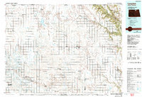
1985 Map of Langdon
USGS Topo · Published 1992About this map
Langdon serves as the central hub of this northern prairie landscape, situated near the Canadian border during the mid-1980s. The region is defined by a dense grid of townships and small agricultural settlements, including Osnabrock, Munich, and Nekoma, many of which are connected by the Burlington Northern railroad lines. To the northeast, the topography shifts dramatically as the flat farmland gives way to the Pembina Hills and the wooded drainages of the Pembina River. This area contains several conservation tracts such as the Pembina Hills State Wildlife Management Area and Walhalla State Woodlands. The map also captures specialized infrastructure like the Robertson Field and Walts Air Service Landing Strip, alongside numerous coulees and sloughs that dictate the local drainage patterns across Cavalier County.
Find a feature on this map
105 named features on this map. Tap any name to fly to it.
Don’t see what you’re looking for? This feature index may not catch every label — zoom into the map to look around manually.
Map Details
Editions of this 1985 Langdon Map
2 editions found

Other maps of this area

1918 · Walhalla
USGS Topo · 1:62,500

1943 · Walhalla
USGS Topo · 1:62,500

1952 · Thief River Falls
USGS Topo · 1:250,000

1953 · Devils Lake
USGS Topo · 1:250,000

1956 · Thief River Falls
USGS Topo · 1:250,000

1956 · Devils Lake
USGS Topo · 1:250,000

1957 · Thief River Falls
USGS Topo · 1:250,000

1957 · Cando NE
USGS Topo · 1:24,000

1962 · Egeland SE
USGS Topo · 1:24,000

1962 · Starkweather
USGS Topo · 1:24,000